Sunday, 18 March 2012

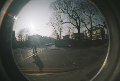
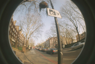
'Capturing', fish eye photographic series No3 (posted on 18/3/12)

Brick Lane, 28-1-12. Photo by N. Georgopoulos


Kitchen, 16-3-12. Photo by N. Georgopoulos


Opposite Angel station , 17-3-12. Photo by N. Georgopoulos


Camberwell , 15-3-12. Photo by N. Georgopoulos


Camberwell , 15-3-12. Photo by N. Georgopoulos


Camberwell , 15-3-12. Photo by N. Georgopoulos


Camberwell , 15-3-12. Photo by N. Georgopoulos


Camberwell , 15-3-12. Photo by N. Georgopoulos


Camberwell , 15-3-12. Photo by N. Georgopoulos


Camberwell , 15-3-12. Photo by N. Georgopoulos

Friday, 16 March 2012

On Guillermo Kuitca's 'Untitled', 1992. (posted on 16/3/12)

Guillermo Kuitca, 'Untitled', 1989. Oil on vinyl covered mattress. Taken from the book 'The Atlas of Emotion' (Giuliana Bruno)


Cartography is increasingly becoming a very popular and central locus of contemporary visual culture, not only because artists are making maps -travel or subversive ones- but because ''... artistic endeavors are curatorially measured and exhibited as maps that chart the trajectory of a movement''.

In 1992, Argentinian artist Guillermo Kuitca, produced a series of works under the title 'Untitled'. The main themes underpinning Kuitca's work is the mapping of history and loss. In this particular series, the artist depicts imaginary maps by painting them on mattresses. The mattress' buttons link areas and territories. The maps emerge in the surface like a stained memory. Hence, the mattress becomes a living document of one's personal history; of what he or she is dreaming of during the night or of which memories recalls when he or she is going to bed. In Guiliana Brunos' words ''... the mattress was a witness. It absorbed a story, some event -perhaps too many events or not quite enough of them. Now, inevitably, it recounts the tale of what was lived, or unlived''. 

This project can be seen as a form of tender mapping. Not because visually it depicts a map. Rather, because it associates an object that symbolizes home and sleep with an image that in real life can not exist there, but emotionally does. This project is an emotional map because ''... travel and home has been in constant interaction''.


A perfect name for his 'untitled' works could be 'burning beds'.


On Guy Debord's 'naked city' (posted on 16/3/12)

'The naked city', Guy Debord & Asger Jorn, 1957. Print screen.


Back in the 50's, through the Lettrist group, a forerunner of the Situationist International, Guy Debord introduced the term Psychogeography whose definition describes '... the study off the specific effects of the geographical environment, consciously organised or not, on the emotions and behavior of individuals'.[1] ''Pick up the map, go out into the city, and walk the circle, keeping as close as you can to the curve. Record the experience as you go, in whatever medium you favor... Complete the circle, and the record ends. Walking makes for content; footage for footage.''[2]

 Tender mapping, a cartographic genre established by Madeleine de Scudery's map of Tenderness in 1654[3], played an important role in the Situationists' psychogeography. Inspired by a 1948 American detective film called Naked City (directed by Jules Dassin), Guy Debord and Asger Jorn designed in 1957 a subversive map of the same name in order to remap Paris on the basis of 'a mobile architecture of living'. The map of The naked city was brought into being by 19 fragments, cut out from a travel map of Paris, whose montage remakes ''... an urban topography into a social and affective landscape''. Through the fragmentation of Paris and its situationist re-construction, the map forms new relations among the city's parts and their inhabitants and reconfigures them with red directional arrows that link the cut outs. In short, through the map of The naked city, the Situationists attempted a remapping of Paris by considering the relationship between spaces and emotions, and as Guy Debord himself stated ''... spatial development must take into account the emotional effects''(Guy Debord, Report on the Construction of Situations, 1958).

In that sense, Situationists' geography of 'lived situations' consists a tender cartography, very similar to the allegorical tactics featured in de Scudery's map of Tenderness, and as Guiliana Bruno puts it ''... in its exploration of the emotional edge of lived space as an affective traversal of the street, situationist mapping constituted itself as a socio-political psychoanalysis of urban space''.


Notes:
1. Debord, G. Introduction to a Critique of Urban Geography
2. MacFarlane, R. A Road of One's Own. Times Literary Supplement, Octomber 7, 2005
3. Bruno, G. (2002) Atlas of Emotion: journeys in Art, Architecture, and Film. New York: Verso.

On Madeleine de Scudery's 'Carte du pays de Tendre' (posted on 15/3/12)

'Carte du pays de Tendre' (the map of the land of tenderness). Designed by Madeleine de Scudery in 1665 for her novel 'Clerie'. First engraved by Francois Chauveau. Taken from the book 'The Atlas of Emotion' (Giuliana Bruno)


Nowadays, people are very much familiar with maps, since such cartographic schemes are inextricably related to the concept of a journey.  Having said that though, there seem to be another genre of cartography with which we may not be so familiar with. Such geography is not intended to identify an existing geographical territory of the world, rather it is about representing the experience -gained through the journey- as a journey.

Tender geography; imaginary cartography; emotional mapping; tender cartography; allegorical geography, all of these terms are indeed very much relevant to be used for describing such navigational schemes. The map of the land of Tenderness (carte du pays de Tendre) is one of the very early examples -if not the first- of such cartographic approach. Designed in 1654 by Madeleine de Scudery for her novel Clelie[1], and first engraved by Francois Chauveau, the map of tenderness is a geographic allegory of emotions and 'relational space'. It is ''... an imagenary cartography of intimate space, where emotions take place and are spatially represented in their motion...''[2].

As far as concerns the narrative context of de Scudery's novel Clelie, the map is said to be a plan designed by the eponymous character in order to show the way to the land of Tenderness. In particular, one can observe a landscape composed by allegorical fixtures, such as imaginary towns, rivers, sea, lakes, trees and mountains. To name a few, there is the 'River of Inclination', 'the Sea of Enmity', the 'Dangerous Sea', the 'Lands Undiscovered', the 'Town of Oblivion', 'the Town of Tenderness', the one of 'Alacrity' and so forth.

Through her book 'Atlas of Emotion', Guiliana Bruno comments that ''... there are no fixed directives for this map tour. In the undetermined itinerary, several movements are possible and encouraged. There are even different destinations.'' For example, if one wants to reach the land of tenderness and approach the undiscovered lands, there are 3 possible itineraries to follow, along which emotional states, in the form of towns, rivers, lakes etc appear. As Bruno notes, ''... these  routes are a spatialized representation of the stages of love''. One can reach 'tender upon inclination' by following the 'river of Inclination', which then leads into the 'Dangerous sea' and beyond, into the amorous 'Lands Undiscovered'. The second possible itinerary to follow in order to reach the aforementioned destination would be to reach 'tender upon Esteem' (respect). Furthermore, one can reach 'tender upon Recognizance' (gratitude). Even though, the aforementioned imaginary itineraries are drawn as 3 different routes which lead to a destination, all 3 of them connect at some point. Exactly, as it happens in real life and in real emotional relations between human beings. ''Time and discourse are not only understood spatially but are mobilised in imaginative ways''.

In conclusion, as Bruno puts it, Madeleine de Scudery's map of tenderness ''... embodies a narrative voyage. That is, it visualises, in the form of a landscape, an itinerary of emotions which is, in turn, the topos of the novel.'' In that sense, ''... the exterior world conveys an interior landscape... ''  and the way ''... to traverse that land is to visit the ebb and flow of a personal and yet social psychogeography.'' Hence, the map itself becomes the voyage and the spectator, its passenger.

Notes:
1. Madeleine de Scudery, Clelie, histoire romaine, 10 vols, Paris: Augustin Courbe, 1654-60
2. Bruno, G. (2002) Atlas of Emotion: Journeys in Art, Architecture, and Film. New York: Verso

Sunday, 11 March 2012

On Ed Ruscha's 'Twentysix Gasoline Stations' (posted on 11/3/12)

Ed Ruscha, 'Twentysix Gasoline Stations', cover, 1963. Print screen.


Ed Ruscha (b.1937) is an American artist who is working with subject matters such as the banality of everyday life. Born in Nebraska and raised in Oklahoma City, throughout his work, Ruscha ''... consistently combines the cityscape of his adopted hometown with vernacular language to communicate a particular urban experience.''

In 1963, Ruscha published his 1st photographic book -which is considered as the 1st artist's book ever been made, a 48-page publication called 'Twenty six Gasoline Stations'. Through out the book, Ruscha documents various of his trips along Rout66, between Los Angeles and his hometown, OKLAHOMA City. In the book 'Ed Rouscha and Photography' it is written that by ''... using his Yashica camera, he took the pictures from across the street, mostly during the day, with the light either behind him or to the side, which emphasized the stations' facades''.

In an interview to Paul Karlstrom between 1980-81, Ruscha said that the title for the book came long before he started taking the pictures. Having said that, it is very much important to consider at this point the fact that the artist belongs to a generation that grew up in an era where the automobile was the symbolism of freedom, and therefore, roads that connected small places with bigger ones seemed to be the medium for 'individual salvation'. ''Ruscha, however, was not interested in cars themeselves as much as in the ride...'' In his essay 'Words as landscapes', Kerry Brougher notes:

''Back in 1956, in the days when those filling stations still pumped ethyl, two 18-years old 'Okies' were making their way across country in a black 1950 Ford. Stopping at nearly every filling station on Route 66 to put another quart of oil in the car, Manson Williams, who would go on to write the hit song 'Calssical Gas', and Ed Rouscha were moving to Los Angeles, aiming straight toward the sunset... the warm weather, beaches, girls and art school =and away from the small-town, repressive environment of Oklahoma City.''

Ed Ruscha, 'Twentysix Gasoline Stations', spread, 1963. Print screen.


Ed Ruscha, 'Twentysix Gasoline Stations', spread, 1963. Print screen.


So, in that sense, when Ruscha made this book through which he showcases (only) photographs he took of Gasoline Stations during his trips on Route 66, he attempts to compose and/or to archive an existential journey through which he broke with his Catholic past and begun his life to become who he is now. He attempts to compose an existential journey -by archiving landmarks of such journeys- for all of us who have been through such itineraries. Gasoline stations are crucial points in a road trip, since without them such journeys would not have been possible. By using his camera more like a capturing device rather than an expressive tool, and by documenting Gas Stations, he attempts to document all these things and meanings that they (Gas Stations) encapsulate. By creating a sequence composed by fragments he observes during his journey, through his right window, he is creating a map; a very subversive one.

In conclusion, as Brougher notes: ''In one of his early paintings, 'U.S. 66 (1960)... still has its feet.. in Abstract Expressionism; but the hovering 'US 66' which is superimposed over the sky... with its missing periods, can be read not only as 'United States' but also as 'us' -we are Route 66''. We have become who we are because of that journey, which 'saved' our lives. While we are approaching our destination we are starting to realise that. And that 'particular urban experience' is the very essence of an existential journey; that of the acquisition of our identity.


Nikos Georgopoulos
London,
March 2012

On Jonathan Ellery's '136 Points of Reference' (posted on 11/3/12)

Jonathan Ellery, '136 Points of Reference', 2005. Print screen.


In 2005, London based Graphic Designer, Jonathan Ellery, released a book through out which he examined the influences ''... that have informed and defined his and the studios’ work.''[1]

Through the book, Ellery is attempting to testify his points of reference; images and objects, books and photographs that, in one way or another, had an effect on, or they are connected to him. It is a personal archive that he wants to celebrate but at the same time to let go. Hence, in order to do that, he has to be sure that he will save it from oblivion by documenting it through photography, since photography's very essence is to reproduce to infinity ''... what could never be repeated existentially.'' [2]

So, in a sense, Jonathan Ellery is immortalizing 136 Points of Reference of his. On that basis, it seems that as a designer, initiates a project that shares the same ideas, in a different form though, with Gerhard Richter's 'Atlas'. It is this very human impulsion for individual commemoration as well as the fear of death and destruction -which oblivion stands for in this particular context- that creates this framework from which such projects emerge within contemporary visual culture.


Notes:
1. http://jonathanellery.com/projects/?id=6&subcat=&cat=3&i=27
2. Barthes, R. (1981) Camera Lucida. New York: Hill and Wang

Nikos Georgopoulos
London,
March 2012

Saturday, 10 March 2012

On Gerhard Richter's 'Atlas' (posted on 11/3/12)

Gerhard Richter's 'Atlas', Sheet No 3. Print screen.


In ancient Greek mythology, Atlas was a Titan whose duty was to hold in his arms the sky -in contemporary terms one could translate the word 'sky' as 'the universe'- and thus, preventing it by falling on earth. However, as Buchloh observes in his essay 'The Anomic Archive', ''...in the 19th century, the term was increasingly deployed in German to identify any tabular display of systematized knowledge (image.1), so that one could have encountered an atlas in almost all fields of empirical science...''.

Gerhard Richter (b.1932) is a world acclaimed German visual artist whose work has helped re-define contemporary painting. In 1962 he begun working on a personal project, called 'Atlas', exhibited for the first time in public in 1972, at the Museum van Hedendaagse Kunst, in Utrecht (image.4). Its synthesis begun with everyday life photographs (sometimes found, sometimes the artist's work) that Richter was collecting as well as donated by friends. Post cards, images extracted by newspapers, pornographic ones as well as historical images such us ''... shots of emaciated concentration-camp inmates...''.

Since its 1st exhibition, Richter's 'Atlas' has been exhibited several times, in different places of the world including 5.000 fragments as well as changes and re-arrangements of its content ''... as an organism that continues to evolve and change''[3], depicting aspects of his personal life, memories and experiences as well as sketches, studies or the artist's various states of being. For instance, when Gerhard Richter was working on the Titian's Annunciation, he did not included in his 'Atlas' the photographic sources and studies that he did on it, while being on Venice, but he included the photographs he took during his stay there, as a tourist.

The whole 'Atlas' is characterized by such configurations and relations between Richter's body of work (public) and its backstage cosmos (private). On that basis, the 'Atlas' is the artist's world, and as much complex and discursive as it appears to be, it is organized into a system (image.3a.b) -that doesn't necessarily follows an order in terms of chronology, but that of content and form- that allows the viewer to observe fragments and through which, to perceive the artist's personality and psychic processes. It is a synthesis, transformed progressively -and conceptually- by fragments into an identity; his identity, as much complex and discursive as a man's identity can possibly be.

In December 2003, 'Atlas' was exhibited for the 1st time in the United Kingdom, at White Chapel gallery, London. The press release, published on the occasion of the exhibition, noted amongst others that the ''... 'Atlas' maps the ideas, processes, life and times of one of the most important painters of the late 20th Century.''

'Atlas of the world'. Print screen.
Hanging plan of the 'Atlas', Gerhard Richter. Taken by the book 'Gerhard Richter: Atlas' (1997)


(detail) Diagram of the 'Atlas', Gerhard Richter. Taken by the book 'Gerhard Richter: Atlas' (1997)


Gerhard Richter's 'Atlas'(1972), exhibition catalogue. Print screen.


Gerhard Richter's 'Atlas', installation view, Stadtische im Lenbachhaus, Munich, 1989. Photocopy.


Nikos Georgopoulos,
London,
March 2012

'Capturing', fish eye photographic series No2 (posted on 10/3/12)

Forstons street, 24-2-12. Photo by N. Georgopoulos


Provost street, 24-2-12. Photo by N. Georgopoulos


Provost street, 24-2-12. Photo by N. Georgopoulos


12, Niagara close, 25-2-12. Photo by N. Georgopoulos


12, Niagara close, 25-2-12. Photo by N. Georgopoulos


28-1-12. Photo by N. Georgopoulos